Silly
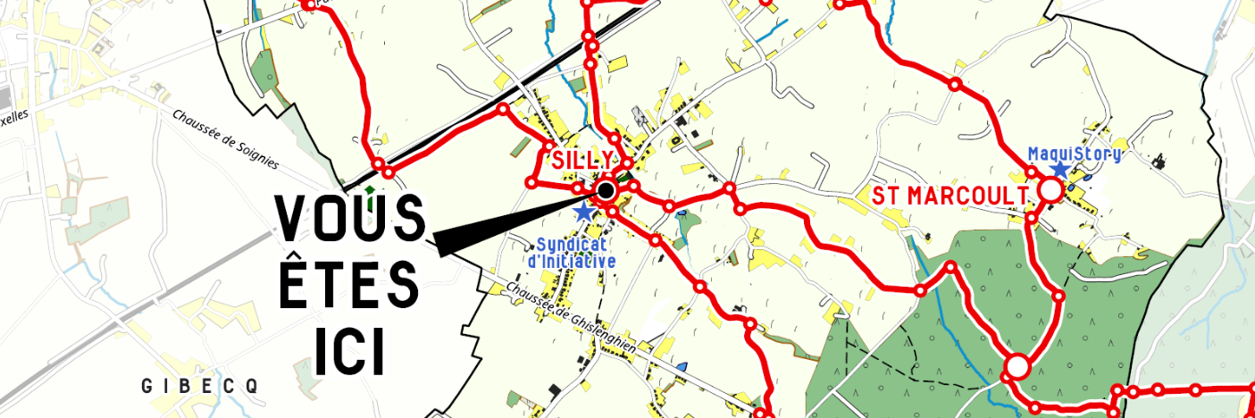
We have produced twelve printed maps for the commune of Silly to mark out a soft mobility network. These maps are displayed in the public space at the points where the soft mobility network intersects and loops between the villages in the municipality. Placed at each major junction, they serve as a reference point when walking. This map of the network has been produced in several versions, with specific information and a "You are here" location for each place. These maps, based on OpenStreetMap data, have been produced entirely in Qgis so that they can be easily updated, for example if there is a change in the soft mobility network. Beacons complete the maps at multiple points along the network, indicating directions and mileage.